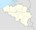
Faýl:Belgium location map.svg
Appearance

Size of this PNG preview of this SVG file: 689 × 599 piksel. Other resolutions: 276 × 240 piksel | 552 × 480 piksel | 883 × 768 piksel | 1 177 × 1 024 piksel | 2 355 × 2 048 piksel | 1 136 × 988 piksel.
Original faýl (SVG faýly, nominal 1 136 × 988 piksel, faýl ölçegi: 120 KB)
Faýlyň taryhy
Faýlyň geçmişini görmek üçin Sene/Wagt bölümündäki senelere tyklaň.
| Sene/Wagt | Miniatýura | Ölçegler | Ulanyjy | Teswir | |
|---|---|---|---|---|---|
| häzirki | 18:26, 23 sentýabr 2010 |  | 1 136 × 988 (120 KB) | NordNordWest | upd |
| 18:42, 25 awgust 2008 |  | 1 136 × 945 (159 KB) | NordNordWest | size correction | |
| 19:01, 9 iýul 2008 |  | 379 × 315 (156 KB) | NordNordWest | {{Information |Description= {{de|Positionskarte von Belgien}} Quadratische Plattkarte, N-S-Streckung 150 %. Geographische Begrenzung der Karte: * N: 51.8° N * S: 49.2° N * W: 2.2° O * O: 6.9° O {{en|Location map of [[:en:Belgium|Belgiu |
Faýlyň ulanylyşy
Bu faýly ulanýan hiç hili sahypa ýok.
Global faýl ulanyşy
Bu faýl aşakdaky beýleki wikiler tarapyndan ulanylýar:
- ar.wikipedia.org sahypasynda ulanyş
- av.wikipedia.org sahypasynda ulanyş
- azb.wikipedia.org sahypasynda ulanyş
- ban.wikipedia.org sahypasynda ulanyş
- be.wikimedia.org sahypasynda ulanyş
- Wiki Loves Monuments/website/Photo tour 28 September 2014/lb
- Wiki Loves Monuments/website/Photo tour 28 September 2014/fr
- Wiki Loves Monuments/website/Photo tour 28 September 2014/de
- Wiki Loves Monuments/website/Photo tour 28 September 2014/nl
- Wiki Loves Monuments/website/Photo tour 28 September 2014
- Uitnodiging voor de fototocht Wiki Takes... Leuven op 28 september 2014
- Invitation to the photo tour Wiki Takes... Leuven on 28 September 2014
- Invitation balade photographique Wiki Takes... Louvain, le 28 Septembre 2014
- bn.wikipedia.org sahypasynda ulanyş
- bs.wikipedia.org sahypasynda ulanyş
- ca.wikipedia.org sahypasynda ulanyş
- ceb.wikipedia.org sahypasynda ulanyş
Bu faýlyň global ulanyşyny görkez.


