
Faýl:Africa-countries-central.png
Wersiýanyň mundan uly ölçegi ýok.
Africa-countries-central.png (360 × 392 piksel, faýlyň ölçegi: 10 KB, MIME tipli: image/png)

|
File:Africa-countries-central.svg is a vector version of this file. It should be used in place of this PNG file when not inferior.
File:Africa-countries-central.png → File:Africa-countries-central.svg
For more information, see Help:SVG. |
 |
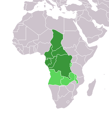
Map of countries in Central Africa.
This map was made by w:User:Joy and originally uploaded to the English Wikipedia as Africa-central-countries.png at 01:32, 28 March 2004. It is a modification of Image:BlankMap-World.png.

|
Permission is granted to copy, distribute and/or modify this document under the terms of the GNU Free Documentation License, Version 1.2 or any later version published by the Free Software Foundation; with no Invariant Sections, no Front-Cover Texts, and no Back-Cover Texts. A copy of the license is included in the section entitled GNU Free Documentation License. |
| Bu faýl Creative Commons Attribution-Share Alike 3.0 Unported lisenziýasyna laýyklykda lisenzirlenendir. | ||
| ||
| This licensing tag was added to this file as part of the GFDL licensing update. |
Faýlyň taryhy
Faýlyň geçmişini görmek üçin Sene/Wagt bölümündäki senelere tyklaň.
| Sene/Wagt | Miniatýura | Ölçegler | Ulanyjy | Teswir | |
|---|---|---|---|---|---|
| häzirki | 18:21, 17 mart 2018 | | 360 × 392 (10 KB) | Maphobbyist | Montenegro border |
| 18:06, 13 ýanwar 2014 |  | 360 × 392 (10 KB) | VVVF | Some corrections | |
| 19:52, 9 iýul 2011 |  | 360 × 392 (13 KB) | Maphobbyist | South Sudan has become independent on July 9, 2011. Sudan and South Sudan are shown with the new international border between them. | |
| 11:10, 5 maý 2006 |  | 360 × 392 (4 KB) | Hautala | optimized with png | |
| 18:30, 29 aprel 2005 |  | 360 × 392 (14 KB) | ChongDae | from en:Image:Africa-countries-central.png {{GFDL}} Category:Maps of Africa |
Faýlyň ulanylyşy
Bu faýla çykgydy bar bolan sahypa:
Global faýl ulanyşy
Bu faýl aşakdaky beýleki wikiler tarapyndan ulanylýar:
- fr.wikipedia.org sahypasynda ulanyş
- he.wikipedia.org sahypasynda ulanyş
- ht.wikipedia.org sahypasynda ulanyş
- incubator.wikimedia.org sahypasynda ulanyş
- is.wikipedia.org sahypasynda ulanyş
- is.wiktionary.org sahypasynda ulanyş
- kaa.wikipedia.org sahypasynda ulanyş
- kbd.wikipedia.org sahypasynda ulanyş
- ko.wikipedia.org sahypasynda ulanyş
- ky.wikipedia.org sahypasynda ulanyş
- mg.wikipedia.org sahypasynda ulanyş
- nn.wikipedia.org sahypasynda ulanyş
- oc.wikipedia.org sahypasynda ulanyş
- pl.wikipedia.org sahypasynda ulanyş
- ru.wikipedia.org sahypasynda ulanyş
- sl.wikipedia.org sahypasynda ulanyş
- smn.wikipedia.org sahypasynda ulanyş
Bu faýlyň global ulanyşyny görkez.