
Faýl:Africa-countries-western.png
Wersiýanyň mundan uly ölçegi ýok.
Africa-countries-western.png (360 × 392 piksel, faýlyň ölçegi: 10 KB, MIME tipli: image/png)

|
File:Africa-countries-western.svg is a vector version of this file. It should be used in place of this PNG file when not inferior.
File:Africa-countries-western.png → File:Africa-countries-western.svg
For more information, see Help:SVG. |
 |
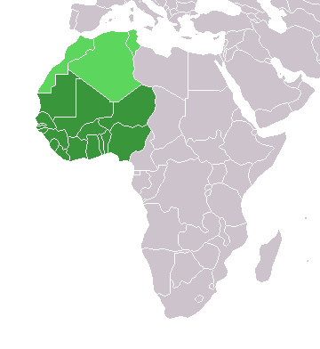
Map of countries in Western Africa.
Originally uploaded to the English Wikipedia:
- 11:32, 3 Feb 2005 . . Lucidity (13890 bytes) (Map of countries in Western Africa)
- 11:12, 3 Feb 2005 . . Lucidity (13885 bytes) (Map of countries in Western Africa)
where it was tagged by Lucidity as GFDL. This map is a modification of Image:BlankMap-World.png.

|
Permission is granted to copy, distribute and/or modify this document under the terms of the GNU Free Documentation License, Version 1.2 or any later version published by the Free Software Foundation; with no Invariant Sections, no Front-Cover Texts, and no Back-Cover Texts. A copy of the license is included in the section entitled GNU Free Documentation License. |
| Bu faýl Creative Commons Attribution-Share Alike 3.0 Unported lisenziýasyna laýyklykda lisenzirlenendir. | ||
| ||
| This licensing tag was added to this file as part of the GFDL licensing update. |
.
Faýlyň taryhy
Faýlyň geçmişini görmek üçin Sene/Wagt bölümündäki senelere tyklaň.
| Sene/Wagt | Miniatýura | Ölçegler | Ulanyjy | Teswir | |
|---|---|---|---|---|---|
| häzirki | 19:10, 17 mart 2018 | | 360 × 392 (10 KB) | Maphobbyist | Upload |
| 23:02, 29 oktýabr 2017 |  | 360 × 392 (8 KB) | أنس | WS current status | |
| 17:30, 13 ýanwar 2014 |  | 360 × 392 (10 KB) | VVVF | As File:LocationWesternAfrica.png | |
| 20:06, 9 iýul 2011 |  | 360 × 392 (13 KB) | Maphobbyist | South Sudan has become independent on July 9, 2011. Sudan and South Sudan are shown with the new international border between them. | |
| 21:35, 31 mart 2011 |  | 360 × 392 (13 KB) | Hoshie | added Cabinda (Angola) and Montenengro to the map. | |
| 11:13, 5 maý 2006 |  | 360 × 392 (4 KB) | Hautala | optimized with png | |
| 21:01, 2 mart 2005 |  | 360 × 392 (14 KB) | Atamari | source en:wiki |
Faýlyň ulanylyşy
Bu faýla çykgydy bar bolan sahypa:
Global faýl ulanyşy
Bu faýl aşakdaky beýleki wikiler tarapyndan ulanylýar:
- incubator.wikimedia.org sahypasynda ulanyş
- kbd.wikipedia.org sahypasynda ulanyş
- kk.wikipedia.org sahypasynda ulanyş
- ko.wikipedia.org sahypasynda ulanyş
- oc.wikipedia.org sahypasynda ulanyş
- pt.wikipedia.org sahypasynda ulanyş
- ru.wikipedia.org sahypasynda ulanyş
- ru.wikinews.org sahypasynda ulanyş
- sl.wikipedia.org sahypasynda ulanyş
- sv.wikinews.org sahypasynda ulanyş
- sv.wiktionary.org sahypasynda ulanyş
- tg.wikipedia.org sahypasynda ulanyş
- uk.wikipedia.org sahypasynda ulanyş
- uz.wikipedia.org sahypasynda ulanyş
- wo.wikipedia.org sahypasynda ulanyş