
Faýl:Kazakhstan location map.svg

Original faýl (SVG faýly, nominal 1 984 × 1 134 piksel, faýl ölçegi: 634 KB)
Gysgaça düşündiriş
| Düşündiriş |
Deutsch: Positionskarte von Kasachstan
Quadratische Plattkarte, N-S-Streckung 150 %. Geographische Begrenzung der Karte:
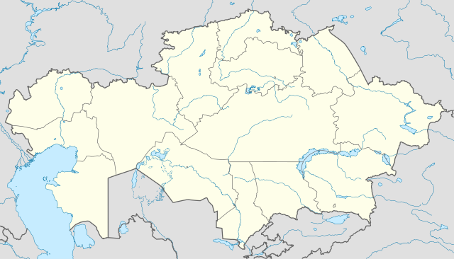
English: Location map of Kazakhstan
Equirectangular projection, N/S stretching 150 %. Geographic limits of the map:
|
|
| Sene | ||
| Çeşme |
Öz işi (eseri), using
|
|
| Awtor | NordNordWest | |
| Rugsat (Bu faýly täzeden ulanmaklyk) |
Bu faýl Creative Commons Attribution-Share Alike 3.0 Germaniýa lisenziýasyna laýyklykda lisenzirlenendir.
 Bu faýl Creative Commons Attribution-Share Alike 3.0 Germaniýa lisenziýasyna laýyklykda lisenzirlenendir.
|


|
This map has been made or improved in the German Kartenwerkstatt (Map Lab). You can propose maps to improve as well.
|
Faýlyň taryhy
Faýlyň geçmişini görmek üçin Sene/Wagt bölümündäki senelere tyklaň.
| Sene/Wagt | Miniatýura | Ölçegler | Ulanyjy | Teswir | |
|---|---|---|---|---|---|
| häzirki | 18:48, 1 awgust 2010 | | 1 984 × 1 134 (634 KB) | NordNordWest | upd |
| 19:15, 27 noýabr 2009 |  | 1 985 × 1 134 (949 KB) | NordNordWest | c | |
| 12:42, 24 noýabr 2009 |  | 1 984 × 1 134 (942 KB) | NordNordWest | c | |
| 12:38, 24 noýabr 2009 |  | 1 985 × 1 134 (941 KB) | NordNordWest | ||
| 18:41, 23 noýabr 2009 |  | 1 985 × 1 134 (516 KB) | NordNordWest | =={{int:filedesc}}== {{Information |Description= {{de|Positionskarte von Kasachstan, '''Vorversion'''}} Quadratische Plattkarte, N-S-Streckung 150 %. Geographische Begrenzung der Karte: * N: 56° N * S: 40° N * W: 46° O * O: 88° O {{ |
Faýlyň ulanylyşy
Bu faýly ulanýan hiç hili sahypa ýok.
Global faýl ulanyşy
Bu faýl aşakdaky beýleki wikiler tarapyndan ulanylýar:
- av.wikipedia.org sahypasynda ulanyş
- bg.wikinews.org sahypasynda ulanyş
- de.wikipedia.org sahypasynda ulanyş
- es.wikipedia.org sahypasynda ulanyş
- fr.wikipedia.org sahypasynda ulanyş
- incubator.wikimedia.org sahypasynda ulanyş
- kaa.wikipedia.org sahypasynda ulanyş
- lv.wikipedia.org sahypasynda ulanyş
- mt.wikipedia.org sahypasynda ulanyş
- pt.wikipedia.org sahypasynda ulanyş
- rue.wikipedia.org sahypasynda ulanyş
- ru.wikipedia.org sahypasynda ulanyş
- sk.wikipedia.org sahypasynda ulanyş