
Faýl:Canada (orthographic projection).svg

Size of this PNG preview of this SVG file: 541 × 541 piksel. Other resolutions: 240 × 240 piksel | 480 × 480 piksel | 768 × 768 piksel | 1 024 × 1 024 piksel | 2 048 × 2 048 piksel.
Original faýl (SVG faýly, nominal 541 × 541 piksel, faýl ölçegi: 487 KB)
Gysgaça düşündiriş
| Düşündiriş |
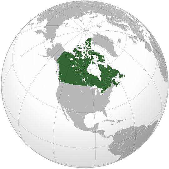
English: Map of Canada |
||||
| Sene | |||||
| Çeşme |
Öz işi (eseri) (Original text: Own work,)
|
||||
| Awtor | Ssolbergj | ||||
| Beýleki wersiýalar |
Derivative works of this file: Map of New Brunswck.png .svg)
|
||||
| SVG genesis |

.svg)
.svg)
.svg)
.svg)
.svg)
.svg)
.svg)
.svg)
.svg)
.svg)
.svg)
.svg)
.svg)
.svg)
.svg)
.svg)
.svg)
.svg)
.svg)
.svg)
.svg)
.svg)
.svg)
.svg)
.svg)
.svg)
.svg)
.svg)
.svg)
.svg)
.svg)
.svg)
.svg)
.svg)
.svg)
.svg)
.svg)
.svg)
.svg)
.svg)
.svg)
.svg)
.svg)
.svg)
.svg)
.svg)
.svg)
.svg)
.svg)
.svg)
.svg)
.svg)
.svg)
.svg)
.svg)
.svg)
.svg)
.svg)
.svg)
.svg)
.svg)
.svg)
.svg)
.svg)
.svg)
.svg)
.svg)
.svg)
.svg)
.svg)
.svg)
.svg)
.svg)

.svg)

.svg)

.svg)
.svg)
.svg)
.svg)
.svg)
.svg)
.svg)


.svg)
.svg)
.svg)
.svg)
.svg)
.svg)
.svg)

.svg)
.svg)
.svg)
.svg)
.svg)
.svg)
.svg)
.svg)
.svg)

.svg)
.svg)
.svg)
.svg)
.svg)
.svg)
.svg)
_without_national_boundaries.svg)
.svg)
.svg)
.svg)
.svg)
.svg)
.svg)

.svg)
.svg)
.png)
.svg)
.svg)
.svg)
.svg)

.svg)
.svg)
.svg)
.svg)
.svg)
.svg)
.svg)
.svg)
.svg)
.svg)
.svg)

.svg)
.svg)
.svg)
.svg)
.svg)
.svg)
.svg)
.svg)
.svg)

.svg)
.svg)

.svg)
.svg)
.svg)
.svg)
.svg)
.svg)
.svg)
.svg)
.svg)
.svg)
.svg)
.svg)
.svg)
.svg)
.svg)
.svg)
.svg)
.svg)
.svg)
.svg)
.svg)
.svg)
.svg)
.svg)
.svg)
.svg)
.svg)
_-_Crimea_disputed.svg)
.svg)
.svg)
.svg)
.svg)
.svg)
.svg)
.svg)
.svg)
.svg)
.svg)
.svg)
_political.svg)
.svg)
.svg)
.svg)
.svg)
_-_Crimea_disputed_-_no_borders.svg)
.svg)
.svg)
.svg)
.svg)
.svg)
.svg)
.svg)
.svg)
.svg)
.svg)
.svg)

.svg)
.svg)
.svg)

.png)
.svg)
.svg)
.svg)
.svg)
.svg)
.svg)
.svg)
.svg)
.svg)
.svg)
.svg)
.svg)
.svg)
.svg)
.svg)
.svg)
.svg)
.svg)
.svg)
.svg)
.svg)
.svg)
.svg)
.svg)
.svg)
.svg)
.svg)
.svg)
.svg)
.svg)
.svg)
.svg)
.svg)
.svg)
.png)
.svg)
.svg)
.svg)
_(orthographic_projection).png)
.svg)
.svg)
.svg)
Lisenzirleme
I, the copyright holder of this work, hereby publish it under the following license:
|cc-by-3.0}}🐸
Faýlyň taryhy
Faýlyň geçmişini görmek üçin Sene/Wagt bölümündäki senelere tyklaň.
| Sene/Wagt | Miniatýura | Ölçegler | Ulanyjy | Teswir | |
|---|---|---|---|---|---|
| häzirki | 17:00, 29 oktýabr 2008 | | 541 × 541 (487 KB) | Ssolbergj | {{Information |Description={{en|1=Map of Canada}} |Source=Own work by uploader |Author=Ssolbergj |Date=29 October 2008 |Permission= |other_versions= }} <!--{{ImageUpload|full}}--> Category:Orthographic projections [[Category:Ma |
Faýlyň ulanylyşy
Bu faýla çykgydy bar bolan sahypa:
Global faýl ulanyşy
Bu faýl aşakdaky beýleki wikiler tarapyndan ulanylýar:
- ady.wikipedia.org sahypasynda ulanyş
- af.wikipedia.org sahypasynda ulanyş
- af.wiktionary.org sahypasynda ulanyş
- als.wikipedia.org sahypasynda ulanyş
- ang.wikipedia.org sahypasynda ulanyş
- arc.wikipedia.org sahypasynda ulanyş
- ar.wikipedia.org sahypasynda ulanyş
- as.wikipedia.org sahypasynda ulanyş
- az.wiktionary.org sahypasynda ulanyş
- bcl.wikipedia.org sahypasynda ulanyş
- be-tarask.wikipedia.org sahypasynda ulanyş
- beta.wikiversity.org sahypasynda ulanyş
- be.wikipedia.org sahypasynda ulanyş
- be.wiktionary.org sahypasynda ulanyş
- bg.wikipedia.org sahypasynda ulanyş
- bm.wikipedia.org sahypasynda ulanyş
- bo.wikipedia.org sahypasynda ulanyş
- br.wikipedia.org sahypasynda ulanyş
- ceb.wikipedia.org sahypasynda ulanyş
- chr.wikipedia.org sahypasynda ulanyş
- chy.wikipedia.org sahypasynda ulanyş
- ckb.wikipedia.org sahypasynda ulanyş
- crh.wikipedia.org sahypasynda ulanyş
- cs.wikipedia.org sahypasynda ulanyş
- cs.wikiquote.org sahypasynda ulanyş
- cu.wikipedia.org sahypasynda ulanyş
- cv.wikipedia.org sahypasynda ulanyş
- da.wikipedia.org sahypasynda ulanyş
- de.wikipedia.org sahypasynda ulanyş
- dv.wikipedia.org sahypasynda ulanyş
- el.wikipedia.org sahypasynda ulanyş
- eml.wikipedia.org sahypasynda ulanyş
- en.wikipedia.org sahypasynda ulanyş
Bu faýlyň global ulanyşyny görkez.
.svg)
.svg)