
Faýl:Africa-countries-northern.png
Wersiýanyň mundan uly ölçegi ýok.
Africa-countries-northern.png (360 × 392 piksel, faýlyň ölçegi: 10 KB, MIME tipli: image/png)

|
File:Africa-countries-northern.svg is a vector version of this file. It should be used in place of this PNG file when not inferior.
File:Africa-countries-northern.png → File:Africa-countries-northern.svg
For more information, see Help:SVG. |
 |
Gysgaça düşündiriş
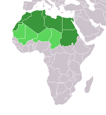
English: Map of countries in geo-political North Africa — as considered by the U.N.
- Credits
from en:Image:Africa-countries-northern.png

|
Permission is granted to copy, distribute and/or modify this document under the terms of the GNU Free Documentation License, Version 1.2 or any later version published by the Free Software Foundation; with no Invariant Sections, no Front-Cover Texts, and no Back-Cover Texts. A copy of the license is included in the section entitled GNU Free Documentation License. |
| Bu faýl Creative Commons Attribution-Share Alike 3.0 Unported lisenziýasyna laýyklykda lisenzirlenendir. | ||
| ||
| This licensing tag was added to this file as part of the GFDL licensing update. |
Faýlyň taryhy
Faýlyň geçmişini görmek üçin Sene/Wagt bölümündäki senelere tyklaň.
| Sene/Wagt | Miniatýura | Ölçegler | Ulanyjy | Teswir | |
|---|---|---|---|---|---|
| häzirki | 15:22, 17 mart 2018 | | 360 × 392 (10 KB) | Maphobbyist | Montenegro border |
| 21:00, 31 mart 2016 |  | 360 × 392 (10 KB) | Fry1989 | Reverted to version as of 16:12, 13 January 2014 (UTC) | |
| 09:37, 7 noýabr 2015 |  | 360 × 392 (10 KB) | Hpyounes | correction | |
| 16:12, 13 ýanwar 2014 |  | 360 × 392 (10 KB) | VVVF | See http://unstats.un.org/unsd/methods/m49/m49regin.htm | |
| 15:59, 13 ýanwar 2014 |  | 360 × 392 (13 KB) | VVVF | Reverted to version as of 20:15, 9 July 2011. See http://unstats.un.org/unsd/methods/m49/m49regin.htm | |
| 12:47, 20 iýul 2011 |  | 360 × 392 (7 KB) | Kahusi | See http://unstats.un.org/unsd/methods/m49/m49regin.htm | |
| 20:15, 9 iýul 2011 |  | 360 × 392 (13 KB) | Maphobbyist | South Sudan has become independent on July 9, 2011. Sudan and South Sudan are shown with the new international border between them. | |
| 11:13, 5 maý 2006 |  | 360 × 392 (4 KB) | Hautala | optimized with png | |
| 16:30, 20 aprel 2005 |  | 360 × 392 (14 KB) | Yonghokim | map of countries in Northern Africa. from en:Image:Africa-countries-northern.png {{GFDL}} |
Faýlyň ulanylyşy
Bu faýly ulanýan hiç hili sahypa ýok.
Global faýl ulanyşy
Bu faýl aşakdaky beýleki wikiler tarapyndan ulanylýar:
- ce.wikipedia.org sahypasynda ulanyş
- es.wikipedia.org sahypasynda ulanyş
- fr.wikipedia.org sahypasynda ulanyş
- he.wikipedia.org sahypasynda ulanyş
- ru.wikipedia.org sahypasynda ulanyş
- sc.wikipedia.org sahypasynda ulanyş
- sv.wikinews.org sahypasynda ulanyş